| Tommy Allen - My Expedition Biography 1972 - 2010 |
 |
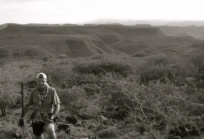
| On foot and camel at the entrance to Samburu - just beyond the Guaso Nyiro River - Kenya 2006 |
|
|
|
1972 - My first journey to Kenya, Yemen and North Africa. This excursion was the catalyst that started me on my road
to discovery and opened up a world of exploration that has lasted the past 30+
years. This was my first journey to
Africa and the Middle East.
While
in Nairobi Kenya, I had the opportunity to meet the famed photographer and
author of The End of the Game, Mr. Peter Beard, as well as the great Explorer Wilfred
Thesiger, in Maralal, northern Kenya.
In Cairo, I was provided the opportunity to see the pyramids of Giza and
the Egyptian museum of antiquities.
In Yemen, I saw an ancient culture surrounded by the grandeur that is
the city of Sanaa; However, of all the places and all of the individuals that I
encountered and spoke with on this trip, it was the words of the late Sir
Wilfred Thesiger and his recollections of remote and wild places that had the
most profound affect on my life.
His recounting of Northern Kenya, Ethiopia, military life, and the empty
quarter of Arabia instilled in me a desire to pursue exploration in Africa and
beyond. His explanation of making human
contact on foot and by camel, the experience of living with and being guided by
men whose language he didn�t understand�these differentiated him as an explorer,
rather than a traveler. He
impressed upon me that if I was to take one thing away from our conversation, it
was the need to learn as many languages as I could and to be defined by the
people I traveled with and encountered, rather than the story line on a travel
poster. Along with Professor Edward
Henry Winter from the University of Virginia, there is no single individual or
event that has had a more profound affect on my life than that chance meeting
with Sir Wilfred Thesiger. This first
journey introduced me to a myriad of cultures, and different points of view,
experiencing a diversity of life that ultimately led me down the path to joining
U.S. Army Intelligence in 1978, allowing me the opportunity to see my first
wild places, learn my first foreign languages and affording me the chance to
participate in and lead expeditions around the world.
|
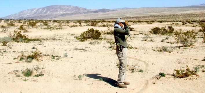 |
| The Mojave desert in winter - one of my favorite locations growing up |
|
|
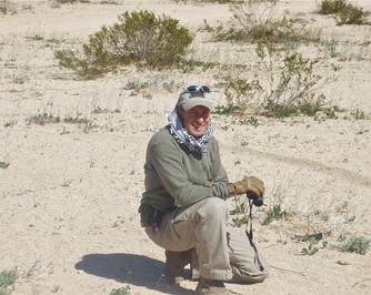 |
| Mojave Desert - 29 Palms - a location of extremes with a high record temp of 119 degrees Fahrenheit in 2005 and a record low of 9 degrees fahrenheit in 1990 one never knows what to expect. It is an incredible location - you either love it, or hate it - I have come to love it over the years |
|
|
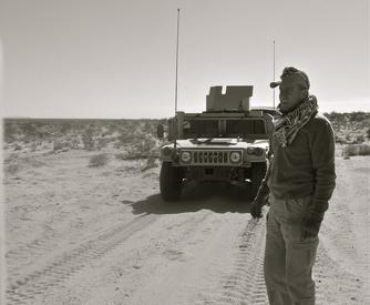 |
| The back of beyond - the Mojave - 29 Palms |
|
|
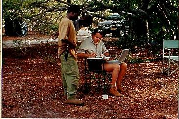 |
| Zambian/Angolan expedition with Joseph Shikombwe and Austin Chulu 1995. Writing down waypoints from my GPS and coordinates from circa 1950's era maps, trying to rectify differences we were seeing on the ground with those on the map - a case of geo rectification real time. As there are many rivers in this area, traveling down the wrong track to a river crossing that is non-existant, or no pontoon can ultimately cost you a day or more. We learned this the hard way on the Luambimba river. |
|
|
1975 – First Expedition to Baja California
1977 – Second Expedition to North Africa and Morocco
1979 – Kenya/Tanzania – Expedition Leader
1979 – Expedition Leader - Climbed the Jungfrau (East Face) - - HF Communications procedures for High Altitude/Alpine Style Climbs – (phase I). Published findings in Army Signal publication – Communications Procedures pamphlet 1 Vicenza Italy.
1979 – Expedition Leader - Climbed Mt. Blanc (Trois Mt. Blanc) - - HF Communications procedures for High Altitude/Alpine Style Climbs – (phase II). Published findings in Army Signal publication – Communications Procedures pamphlet 1 Vicenza Italy.
1979 – Co-Leader - Climbed the Eiger (Lauper Route – North East Face) - - HF Communications procedures for High Altitude/Alpine Style Climbs – (phase III). Published findings in Army Signal publication – Communications Procedures pamphlet 1 Vicenza Italy.
1979 – Communications Officer - Crossed the Sahara from Agadez to Bilma across the Tenere Desert with an element from the main body of Tuaregs as they gathered salt in Bilma to take back to Agadez and beyond. Took SATCOM and man portable HF equipment to test in extreme desert conditions. Utilizing early map software and GPS technology, created GIS track and map – expedition report published and photographs exhibited at Marco Gallery in Vicenza, Italy, with lectures and slide shows given to COMLAND South Verona, and Museo de Civico, Vicenza, Italy. Expedition sponsored by US Army, Caserma Ederle, and Italy’s North African Institute of Administrative science.
Received Army Commendation Medal for my efforts in pushing limits of communications technology
|
 |
| Pokot country Kenya - 2008 |
|
|
|
1981 �
Expedition Leader - July/August - Pakistan - Mountain expedition
from Chitral to Hunza through Pamir, Hindu Kush and Karakorum Mountains � in
search of textiles comparing tribal motifs along the Wakhan corridor and
Hunza. Photographic account of the
expedition.
1982 � Expedition Leader - July/August - Pakistan � In search of Baluchi
weavings. Purpose of expedition
was to locate and document salt bags and saddlebags of the migratory Baluch.
1984 � Expedition Leader - Uganda/Zaire/Sudan � Documenting and mapping
poaching along the tri-border area � tracking elephants in Southern Sudan,
Northern Uganda, and the northern Congo (Zaire) � Expedition was funded through
subscriptions throughout the Charlottesville/Albemarle area(s) as well as the
University of Virginia. Purpose of
expedition was to link Arab horsemen entering from the Sudan to poaching in the
Northern Areas of Zaire/Uganda. Trip
Report briefed to U.S. State Department and Department of the Interior
Washington D.C. � Received Letter of Commendation from Bureau of African Affairs
for efforts. Lecture series at the
University of Virginia on various aspects of the journey.
1985 � Kenya � Solo Expedition
(accompanied
by 4 Kenyan Wildlife Service employees in support role) along the Matthews Range in Northern Kenya in search of elephant
routes of the last large tuskers.
This expedition was self-funded with technology support provided by
Envision Productions, in Southern California. Purpose of this expedition was to photograph and record the last
great tuskers roaming the northern desert regions of Kenya. The goal was to gather data that would
substantiate the establishment of safe passage corridors for these large elephants
as they moved along populated areas.
The previous year there had been sightings of at least three extremely
large elephant seen moving along the luggas in the more remote stretches of the
Matthews range and the Ndotos. It
was believed that these large tuskers were roaming as far south as the Tana
River and as far north as the Matthews Range. This expedition was mounted using
two Land Rovers and setting out each morning from various fly camps. When large
prints were located, the location and print were recorded, and at that point I
would set out with one KWS scout on foot to try and locate the elephant. After 28 days, numerous elephants
in the 65 � 80lbs (ivory per side) were found and two extremely large sets of
prints were recorded; however, no elephants with 100-lbs plus of ivory per side
were recorded. I did, however, record
a herd of some 45- plus Grevy�s Zebra while moving between the Milgas and the
Ndoto mountain ranges - this being the largest herd of Grevy�s I have
personally witnessed in Kenya.
|
 |
| Okavango Delta - Just below Caprivi 1991 |
|
|
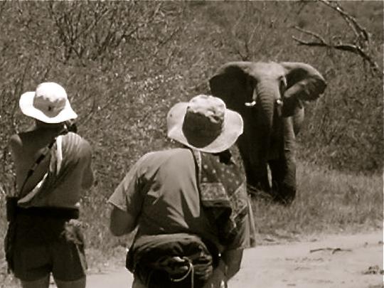 |
| Laikipia Plateau 2006 - just beyond the Guaso Narok. Videotaping a cheeky young bull with my companion and author Dennis Wininger looking on (Proper Walk - My Journey to Help the Children of Makindu. by Dennis Wininger). |
|
|
|
1986 � 1988 � During my assignment with
the State Department at the U.S., Embassy Mogadishu, Somalia, I had the
opportunity to make some 47 trips into the interior and four overland trips
between Mogadishu, and Nairobi. I
completed some 26 reports dealing with various aspects of the clan/tribal
dynamics of the Somali and returned to Somalia 16 times between 1991 and 1994,
being one of the last Americans out of the country during the final days of the
U.N. intervention.
1986 � Expedition (1) Somalia � Solo (accompanied by two Hawiya clan members)- In
cooperation with Hugh Lamprey of WWF Kenya and funding provided by U.S Aid and the
U.S. Embassy Mogadishu, Somalia � conducted 20-day survey between the Webi
Shebelle and Juba Rivers in what is known as the riverine area to determine if
elephants were still present in Somalia. Between the Rivers Shebelle and Juba, 9
elephants were found along with five lion and two leopard. Received support from local Hawiya
Elders who passed along stories of herds between 45 � 70 elephants moving
through the heavy brush along the riverine area of central Somalia just a few years�
previous. An arduous journey owing
to the difficult terrain � hostility of some Somali clans was evident but not
as pervasive as on second trip.
1987 � Expedition (2) Somalia � Solo (accompanied by four Hawiya clan members)� In
cooperation with Hugh Lamprey of WWF Kenya and money provided by U.S Aid and
the U.S. Embassy Mogadishu, Somalia � conducted 2nd 20-day survey
between the Webi Shebelle and Juba Rivers in what is known as the riverine area
to determine what wildlife still remained. On this expedition, no elephants were found; however, two
tracks were followed for 9 days before disappearing along the Juba River. Three lions were located and the tracks
of leopard, civet and genet cats were found, as well as one caracal spotted. Hippo was found on the middle stretch
of the Shebelle, as were large numbers of crocodiles; however, extensive
poaching of kudu and other antelope species was evident. A strenuous trek, owing to the
difficult terrain and the open hostility with some of the Somali clans that had
moved into the area from points further south. As a result of this second journey, an aerial survey was conducted
by WWF Kenya and only three elephants were spotted during the entire 7-day survey. These could very well have been the
last elephants between the rivers and perhaps some of the last remaining in the
country.
1987 � Expedition (3)- Somalia to Kenya by foot and camel � Accompanied by four Somali
herdsman and two Kenyans, I made what was probably the first overland expedition
of the southern route by foot and camel since the early 1900�s. This expedition took me from just south
of Kismayu in Southern Somalia to the swamps of the Lorian on the banks of the
Uaso Nyiro River in Kenya. The
objective of this expedition was twofold: first, to survey the clan clashes
along the southern half of Somalia where the Marehan (then President Siad
Barre�s clan) had been taking over more and more land. This act put pressure on
groups that had been living in the southern region for decades, causing a shift
in the political landscape and creating a real potential for violence. The second objective was to retrace the
route of a little known expedition made by Captain R.E. Salkeld in 1913. Dr.
Donaldson Smith and several of the early British explorers that passed through
this area displayed an impressive degree of accuracy in not only documenting
the various waterholes that we relied on, but more importantly the accuracy in
pinpointing these locations to a degree that our modern GPS was hard pressed to
better. Results of this expedition
were published in USIA bulletin number 14, as well as interviews with the East
African Standard and The Times.
Upon completion of the expedition, my tracker and friend Elmi Mohammed
took us to his Somali community in Garissa (where Elmi�s extended family lived). The Somali community was so taken by
the feat we had accomplished that the local Sheikh provided Elmi with a worn Koran,
and I was presented with an antique Somali dagger made from elephant ivory and
giraffe skin.
1988 � Somalia � Expedition
Leader - From Mogadishu to the Ogaden by Land Rover On this 17-day expedition
the goal was to map the tribal distribution between Mogadishu and the
Ogaden.
1991 � Namibia (Communications
and Security officer) � First expedition following the cessation
of hostilities. Entered Angola
along the Kunene River from Namibia observing both the Epupa and Ruacana Falls
by foot. Purpose of expedition was
to survey the affects of the war on the Kunene River and its environment. Expedition took 26 days and covered
some 153 miles. Expedition ended on the West side of the Zambezi River along
the Ngonye Falls � the little visited but spectacular falls in Western Zambia.
1992 � Kenya � Self-funded ten-day
Threatened Species Expedition on the Tan River by indigenous canoe from Idsowe
to the Indian Ocean (solo with 4 Kenyan guides from the Tana River area and the coast) �
Purpose of Expedition was to locate and photograph the following threatened species:
Great White pelican, Pink-backed Pelican, African Open-billed Stork, Southern
Banded Snake Eagle, Malindi Pipit, Tana River Cisticola, and Saddle-billed
Stork. Five of the seven species
were photographed from a total of 112 bird species recorded. In addition, thirteen primate species,
and twelve mammal species were documented on video and still photography. Twelve continuous hrs of video
was recorded along the river. Species
list and documentary video was donated to the Tana River Primate Center for
conversation use and public awareness of the fragility of the Tana River
ecosystem.
1993 � Zambia � Accompanied by nine Zambians from Chief Chipungu's boma -
Expedition around Lake Bangweulu past Chitambo�s village starting at a point
just south of Chief Chipungu's residence through Chipili province to the
resting place of David Livingstone.
This journey was as much an expedition as it was a journey back in
time. I wanted to experience the
hardships that David Livingstone had endured during his march toward the
Lualaba and his quest for the source of the Nile.
|
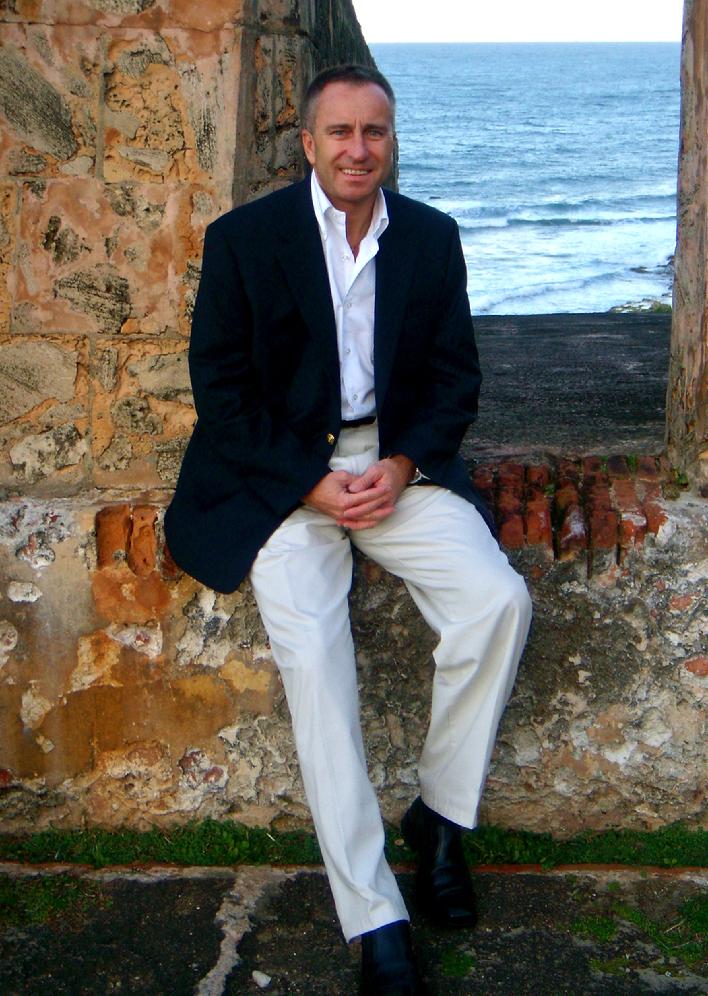 |
| On the fort wall at Old San Juan - just prior to a fundraiser/lecture on my expedition to Argentina and the Rio Bermejo - 2007 |
|
|
|
1993 -1994 � South African
Elections � U.S. Embassy Pretoria, South Africa � Venda, Phalaborwa, Northern
Transvaal (Solo) (Linguist: Xhosa/Zulu) � During the month of October
1993 through the historic multiracial elections that took place in April of
1994, I was provided the chance while carrying out my duties with the American
Embassy the opportunity to travel extensively through some of the most isolated
and undeveloped areas in what is now the Limpopo district. Venda is situated in the Southpansberg
Mountains and culturally is one of the most undisturbed areas in South Africa. With a culture that has its roots in
the Sotho, Nguni, East and Central African cultures, the VhaVenda believe in
mythical creatures and have a both a wonderful and mysterious relationship with
crocodiles � believing them to have a poisonous brain, thus allowing them to
live undisturbed in their waters. My time spent amongst the Venda shaped the way I interact and
perceive other African cultures.
The black and white South Africans that I was fortunate enough to
befriend over the course of this unprecedented and historical event left me even
more in awe of the continent and its people than I thought possible.
1994 � Kenya/Uganda � Karamoja
land � Solo �
I was afforded the opportunity to spend nearly 22 days amongst the Karamoja on
both sides of the Kenya/Uganda border.
While on leave from the U.S. Embassy in Lusaka, Zambia, on a visit to
Nairobi, I met a team of researchers from the Kenyan Ministry of Health that
were looking for transportation to the Karamoja region of Kenya. I was determined to spend time on the
Eastern side of Lake Turkana, and the fact that I had a Land Rover at my
disposal, made it an easy diversion from my original goal and offered me the
opportunity to live with a tribal group that in many ways had remained as they
were years ago. While the spears
and bows in some cases had been traded for AK-47�s, in many ways their customs
and way of life had remained.
During these 22 days I witnessed revenge killings, cattle rustling, dust
storms, and a way of life that has persisted for centuries. Ritual dancing and the customary
ceremonial events that typically are afforded a guest allowed me to get a
glimpse of this group of people that no expedition under typical time
constraints could have allowed. An unintended outcome of this trip was the utilization of my handheld SATCOM
terminal to send scanned images of the lower leg of a child snakebite victim (cobra)
for Physician interpretation--first time this technique was used in Northern Kenya. Upon my return to Nairobi, I briefed
American Embassy/USAID officials on activities in northern Kenya, and how they
might better address distribution of resources to remote communities. In addition, six months later I met
with GE Medical systems and discussed the technological needs and the
opportunity for advanced technologies to play a part in rural African
healthcare.
1995 � Zambia/Mozambique �
Co-Leader �
Foot Expedition from West Petauke GMA (Game Management Area) on the Luangwa
River to the Zambezi River through the Mpata Gorge and onward toward Mozambique
� looking at settlement and illegal logging along the two rivers � the affects
of poaching along the Luangwa and Zambezi Rivers. Funded by ADMADE/USAID.
1995 � Zambia � Barotseland � Co- leader with Joseph
Shikombwe � Expedition from Mongu in Western Province to the home of the
paramount Chief of the Barotse at Lealui, onward to Liuwa Plains and overland
through the sand beds of Angola, to Park Nacional da Cameia across the border
into the DRC, and back down to Zambia via Mwinilunga, down the West side of the
Zambezi River crossing the Lunwebungu, Luambimba, Luanginga, and the Luanchi
Rivers, along the edge of the Nyengo Swamp to Sikongo and back to Kalabo,
Mongu, Kaomo, and ultimately back to Lusaka. This journey was over 1360 driving miles and covered most of
the major tributaries of the upper Zambezi River. Goal of the expedition was to look at the impact of the
Angolan war on these upper regions of the Zambezi watershed. The proliferation of wildlife and
the existent tribal life of this region were very unexpected considering the
duration of the Angolan civil war and the intense fighting that took place
throughout this region. The Chokwe
and Luena tribes of this area were both hospitable and welcoming as we passed
through villages that most likely had never seen western travelers outside of
the occasional Cuban/Russian advisor.
An incredible journey through an area that was for me as wild and
beautiful as any locale I had witnessed in Africa.
1997 � Solo - DRC Congo (Formerly
Zaire) � Trip 1 (21 days) - Likasi - After the fall of President Mobutu Sese Seko, and
the complete breakdown of law and order in the Eastern Congo, was asked by a
private group of donors to enter the DRC and Likasi, in particular, to
undertake a survey of the environmental degradation caused by mining and
illegal logging since the fall of Zaire. What I found over the course of these two trips and
approximately 38 days in country was an area the size of Washington D.C., that
had been completely exploited to the extent that environment reclamation and
recovery might be next to impossible. Findings from these two trips were incorporated into
�Environmental Liability in the Mining Sector� that was presented to the U.S.
Embassy in Kinshasa, DRC and to the United Nations Environmental Survey Group. The route that I undertook in order to
reach Likasi was similar to other Central African Expeditions I had been
involved with, in that both the security situation and the mode of travel
varied with the day of the week.
The variety of transport ranged from walking for several days by foot,
to traveling some seven or eight miles by taxi before the driver (having
reached a particular check point) was obliged to turn around by virtue of tribal
affiliation, and/or one�s appearance.
Either way, the drivers felt they were not safe to proceed. Armed village skirmishes were the norm
and the level of fighting and internecine violence escalated the farther north
I ventured. The highlight of this
journey was meeting a Songye Inyanga (healer) who gave to me some four small
Songye fetishes that remain some of my most prized possessions from the DRC
(Congo/Zaire).
1997 � Solo - DRC Congo (Formerly
Zaire) � Trip 2 (17 days) - Likasi � documenting environmental degradation caused by
mining and illegal logging. ((See
above)).
1997 � Solo Expedition down
the Congo (Zaire River)� DRC Congo (Formerly Zaire) � Expedition from Kisingani
down the Congo River to the Lomani tributary of the Congo into Songye land. My purpose in undertaking this
expedition was to explore what affect the prolonged hostility in the eastern Congo
had on fetish production among the inhabitants. When I had visited the area in 1994, war fetishes and/or
small charms were being utilized by men going into the jungle for protection
against other Congolese tribes. Having
observed the Songye and collected their fetishes in the past, this was both an
opportunity to explore the Congo River by canoe, as well as observe life along
a river made famous by both Stanley and Conrad, gaining perspective on an area
that had been ravaged by turmoil for decades. The result of this expedition was the realization that
fetish production was live and well and while the artistic quality had changed
somewhat the level of creativity and the variety of modern ephemera being utilized
was on the rise. I found some 47
pieces during this expedition that were ultimately donated to the MOTO MOTO (fire fire, in Bemba) Museum located
in Mbala, Zambia.
1998 � Papua New Guinea � Member Sepik River and San-daun Exploration �-Australian Army Expedition
up the Sepik River to the San-daun Province near the Irayan Jaya border � focus
of the expedition was to circumnavigate the Green River and Mountainous region
surrounding the Green River and Amanab areas. This location is filled with deep valleys, swampy
floodplains and extreme isolation from nearby villages. An additional outcome of this expedition
beyond surveying the extremely rough and isolated terrain was to verify reports
of sightings of Thylacinus cynocephalus or the Tasmanian Tiger by villagers
along the border region; However, after some nine days on the Sepik and 19 days
in the interior, the expedition was picked up and flown out with four cases of
Malaria and several other problems associated with spending considerable time
in swampy, mosquito-infested areas.
Signs that the Tasmanian tiger might still exist in the border region of
Irayan Jaya and Papua New Guinea could not be confirmed as the team found no
signs of this species long considered extinct. A very difficult experience, and one that left me in awe of
this wild and remote Island nation.
2001 � Pakistan � Tribal Survey along the Afghan/Pakistan Border � Just prior to
9/11 and the turmoil that engulfed the region, I had the opportunity to conduct
an Expedition through the Peshawar region to the Khyber pass and then down
along the Zhob river to Quetta, continuing to the Bolan pass and along the
border to just north west of Nok Kundi on the Baluchistan Plateau transecting
some of the most ancient trade routes in central Asia. This expedition resulted in the
cataloging and acquisition of three mid-nineteen century Baluch saddle bags
that were found just north of Nok Kundi, as well as photographs being taken at a Mosque below Quetta of some 47 early 20th century Kilims
and utilitarian bags. Scanning and
transmission of images was carried out with new techniques in bandwidth utilization
across commercial handheld SATCOM.
Digital images were uploaded to ontheflyexpeditions.com website for
later processing. Expedition
was followed on explorersweb.com website using GPS coordinates uploaded to
moving map that allowed expedition sponsors and followers to chart progress
along the route. This is now
considered the normal communications kit utilized by Himalayan climbers and
alpine style ascents where minimal equipment is desired by virtue of size and
weight, yet ease of use from direct connect SATCOM is desirable.
|
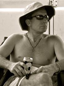 |
| Enjoying a Tusker in Laikipia Kenya after a long journey |
|
|
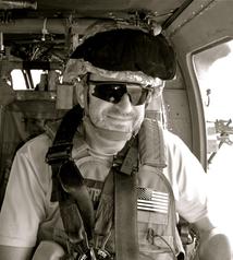 |
| Flying back to Taji Iraq |
|
|
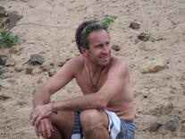 |
| After 20 plus miles walking with the camels - resting along the banks of the Guaso Nyiro 2006 |
|
|
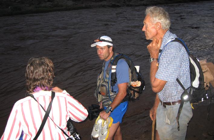 |
| Amanda, Roger, and I look on in disbelief as the Guaso Nyiro rushes by. Roger and I heard the sound while sitting around the campfire the night before. It sounded like a freight train a long distance off - when we awoke in the morning, the river and crested it's banks and the water was rushing by where the evening before we had sat and bathed. We lost a day on this stretch of the river as we could not cross with the camels until late into the afternoon - it truly was a most incredible sight |
|
|
|
2006 - Communications
Officer/Videographer - Kenya - Proper Walk - Guaso Nyiro River - From Chanler Falls to
Laikipia by foot with camels - provided communications support and web updates
for expedition. Purpose of
expedition was to raise awareness of the Aids pandemic and look at environmental
changes along the Guaso Nyiro from Chanler Falls. Proceeds of the expedition went to the Makindu Children's
Center in Makindu, Kenya. Produced video for California-based Envision
Productions -sixteen hrs of footage and documentary support. Lecture series followed expedition. News articles and interviews with the Washington Post, Richmond Times Dispatch,
and Goochland Gazette.
2008 - Communications
Officer/Videographer - Kenya - Proper Walk - From Mochongoi Point in the Great Rift
Valley down the Laikipa escarpment to Wasegas along the valley and back up the
Laikipia Plateau. From the
Laikipia Plateau we crossed down an old track that had not been used for many
years. Once at the bottom of the
lake floor we walked around the lake and onto Lake Baringo up to the Pokot Mission
at Cacatoto to the top of the Rift Valley with the Saguta in the distant
background. From Cacatoto we
descended to the base of the Laikipia escarpment and along the plateau to Mugie
Ranch, where we completed the walk.
Once again I provided all of the SATCOM communications support and web
updates for the expedition.
Purpose of expedition was to raise awareness of the Aids pandemic, in addition, I tried to document
environmental changes along the course of the walk. Produced video for
California based Envision Productions to include nine hrs of footage and
documentary support. Lecture
series followed expedition. (Raised in excess of $10,000 for Makindu Children's Orphanage).
2008 - Rio Bermejo River,
Argentina - I floated the length of the Rio
Bermejo River from the Rio Saco to the Rio Paraguay. To my knowledge this is only the 2nd time this
has been accomplished since the 1st Leach expedition was carried out
in 1899 and recorded by Captain H. Bolland.
2008 - 2009 - Iraq - Civilian Contractor assigned
with The Department of Defense, U.S. Army Rapid Equipping Force working with
Task Force Troy/EOD operations in support of Operation Iraqi Freedom (OIF). Primary focus in Iraq centered on technology for EOD operations. While in Iraq, I was able to conduct three
separate journeys in Northern Iraq (Kurdistan) following the routes of Arthur
Henry Layard as he searched for the ancient city of Nineveh.
2010 - Afghanistan - Depart for Afghanistan, May 2010 for a 1 yr assignment with the U.S. Army Rapid Equipping Force working
with Task Force Paladin/EOD in support of
Operation Enduring Freedom. I have several expeditions planned while in Afghanistan, security situation permitting.
2011 - Kenya - Planned
expedition to re-trace the Footsteps of American explorer, Willam Astor Chanler. This expedition will follow the American's route up the Tana
River, along the Guaso Nyiro River, turning northward toward Lake Turkana. The
focus of the expedition will be to chart environmental changes along the
expeditions water course since the historic journey in 1893. Primary focus will be on the
environmental degradation along the Guaso Nyiro, focusing on illegal settlements
around Chanler falls and over usage of scarce water resources during the dry
season by large-scale commercial farms. Of equal importance is to shed light on a most important
American explorer and his little known accomplishments. Route advice and historical assistance is being provided by
Dr. James Pascal Imperato (Life Fellow of the Explorers Club New York) an
expert on Northern Kenya and Lake Turkana, as well as Mr. J.W. Aldrich, the
grand nephew of William Astor Chanler the explorer whose route this expedition
intends following.
|
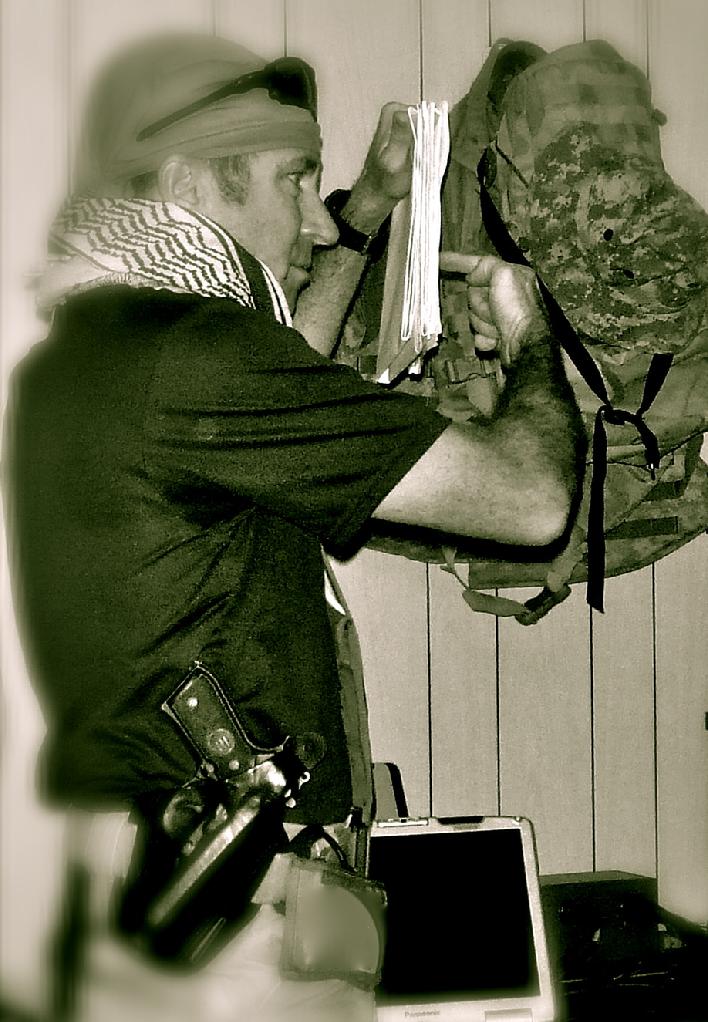 |
| Briefing in Iraq - 2009 |
|
|
|


