 |
| William Astor Chanler |
|
|
 |
| Chanler reedbuck |
|
|
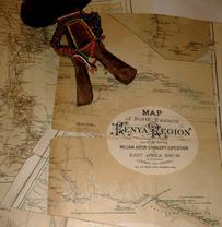 |
| Chanler map |
|
|
|
CHANLER, William Astor, (1867 - 1934)
CHANLER, William Astor, (son
of John Winthrop Chanler), a Representative from New York; born in Newport,
R.I., June 11, 1867; attended St. John�s School, Ossining, N.Y., Phillips
Academy, Exeter, N.H., and Harvard University for two years; Fellow of the
Royal Geographic Society of London; explored the territory in the vicinity of
Mount Kilimanjaro in 1889; delegate to the State Republican convention at
Saratoga in 1896; member of the State assembly in 1897; during the
Spanish-American War was appointed captain and assistant adjutant general of
Volunteers on May 10, 1898; served as acting ordnance officer, Cavalry
Division, Fifth Army Corps, from May 23 to August 23, 1898; participated in the
Battle of Santiago; elected as a Democrat to the Fifty-sixth Congress (March 4,
1899-March 3, 1901); was not a candidate for renomination in 1900; traveler,
author, and explorer; moved to Europe in 1920; died in Menton, A. M., France,
March 4, 1934; interment in Trinity Church Cemetery, New York City.
|
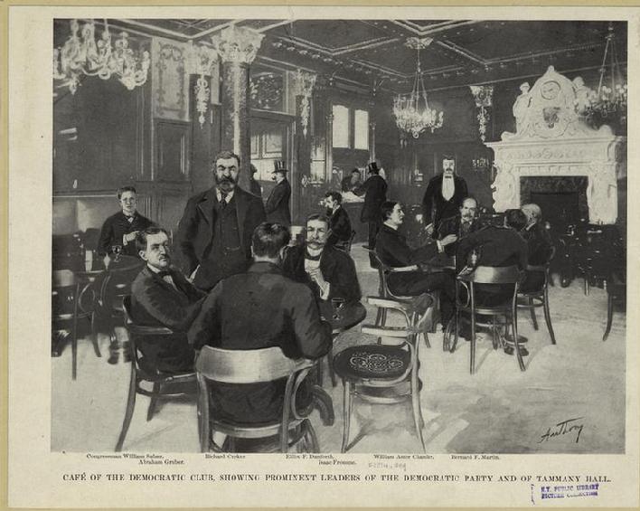 |
| William Astor Chanler at the Democratic club |
|
|
 |
| Preparing the camera gear along the track that runs to Chanler falls at the start of Proper Walk 2006, and just prior to linking up with our camels and team - the dirt track leads over the scrub like landscape onto the Lava field just above the falls - one of the most beautiful settings along the Rift valley |
|
|
 |
| On the track to Chanler falls |
|
|
|
(Quote from page 118 - Through Jungle and Desert; Travels in Eastern
Africa) by William Astor Chanler.
(Begin Quote)
Toward noon, just as I began to think of halting for our mid-day
meal, a dull roaring sound reached my ears. After going a half mile
further, the noise increasing all the while, we reached a point where the plain
fell to the level of the river. There we found explanation of the sound.
The Guaso Nyiro, meeting a wall of black lava in its course, flows over it, and
has a drop of sixty feet. Even at the season of the year when we visited
it, and when the Autumn rains had been very slight, the falls presented an
imposing appearance. The wall of lava, being higher in the middle then at
the sides divided the river into two streams. Below the falls these two
streams again met, and forced their way between two precipitous walls of black
lava; foam was churned and thrown high into the air, and the leaping, tumbling,
frothing stream had a really wild and savage aspect. This place we named
Chanler Falls. We pitched our camp
five miles below the falls, at which point the river again perfectly wended
it's way between rows of tall palms.
(End Quote)
|
 |
| Chanler Falls on the Guaso Nyiro in August 2006 |
|
|
|
In the footsteps of Chanler - Kenya 2011
Continue to check back as I upload additional information on the fascinating story of William Astor Chanler. I will be exploring his 1892-1894 expedition in some detail, as well as discussing plans and preparations surrounding my upcoming expedition, "In the footsteps of Chanler,"an expedition along the Guaso Nyiro River in Kenya's northern frontier district - July-August 2011.
Tommy "Mbogo" Allen 03/23/2010
|
 |
| Looking north across the Guaso Nyiro river just below Chanler falls. Just below the falls it opens into a wide area of sand islands and large boulders with Doum palms lining the edge of the river |
|
|
 |
| The snake like trail (middle of frame) of the Guaso Nyiro River |
|
|
 |
| Scene from the lower stretch of the Guaso Nyiro |
|
|
 |
| Waters from the Guaso Nyiro are fed from the clear mountain streams that have their source high on Mt. Kenya. The depth of this river can change dramatically as we found in 2006 when rains caused the river to rise some 9 feet in less than 7 hrs, causing us to lose a day until the waters subsided and we were able to cross the river with our camels |
|
|
 |
| Crossing a swollen Guaso Nyiro - by this time the water and subsided by some 3 -4 feet in the late afternoon, allowing us to cross with the camels |
|
|
 |
| The final crossing - Guaso Nyiro |
|
|
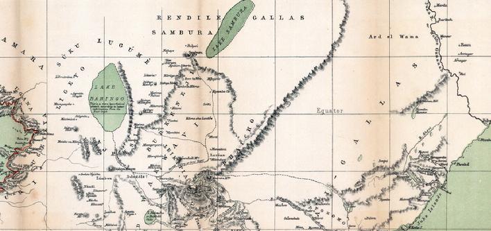 |
| What the East African landscape looked like around Turkana (Sabura), Mt. Kenya, and the Guaso Nyiro in the mid 1870's - some 20 years before Chanler would visit this area (Lake Bogoria is the small green circle bottom center of map) |
|
|
 |
| Original maps from the Teleki/Von Hohnel, Chanler/Von Hohnel expeditions - artwork of Pokot woman in my diary by the talented artist Ashley Wolff |
|
|
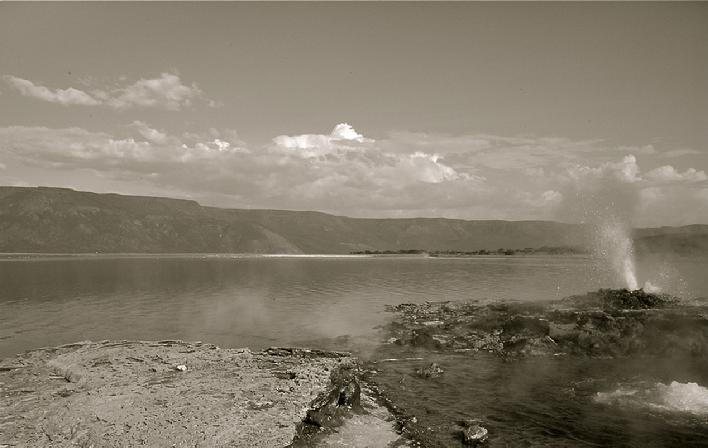 |
| Lake Bogoria - looking west across the excarpment with hot springs and geysers in the foreground |
|
|
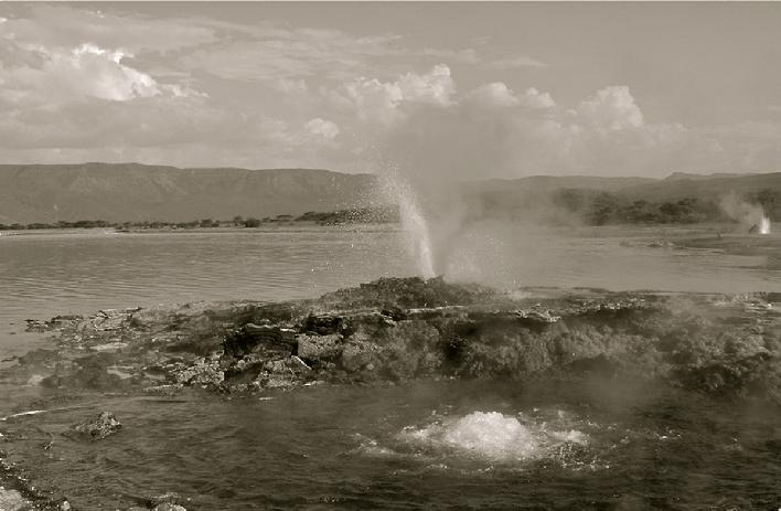 |
| Lake Bogoria contains more true geysers than any other location in Africa - I believe the number to be 16 or 17 in total - possibly more |
|
|
 |
| Our camels high on the Bogoria escarpment |
|
|
 |
| The route down the escarpment was as rough as any I have seen outside of the highlands of Ethiopia, or the Atlas mountains in Morocco |
|
|
|